Coastal Watersheds
Humptulips River Watershed

Imagine spending time floating on a slow flowing river. Envision bright sunshine sparkling on cold mountain streams and hikes through coastal forests as they transition into rainforests. Coastal watersheds link the habitats of Washington’s Pacific Coast from headwaters to bays and the open ocean. They also provide ample opportunity for recreation.
The Humptulips River forms one of the northern tributaries of the Chehalis River watershed. The name is unique with two different meanings attributed to it: “Hard to pole” and “chilly region”. A small town located along the river at its intersection with US HWY 101 also bears the name. Recreation opportunities along the river include fishing (particularly salmon fishing), hiking, canoeing, and kayaking. The Humptulips River watershed covers approximately 276 square miles and has an estimated length of between 50-60 miles along its longest reach. The river has two main tributaries, the West Fork Humptulips and the East Fork Humptulips.
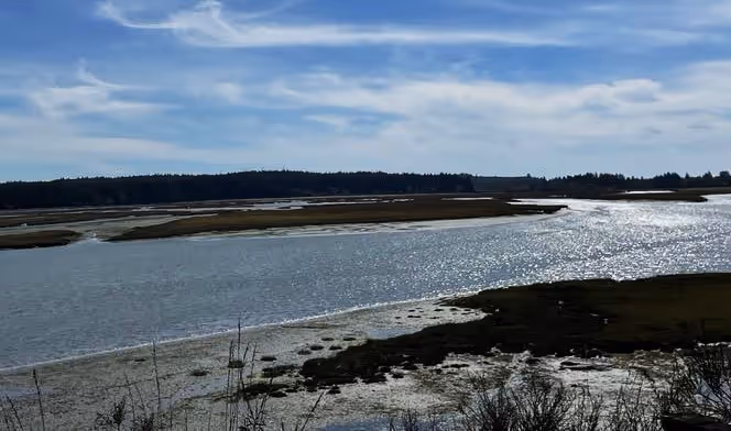
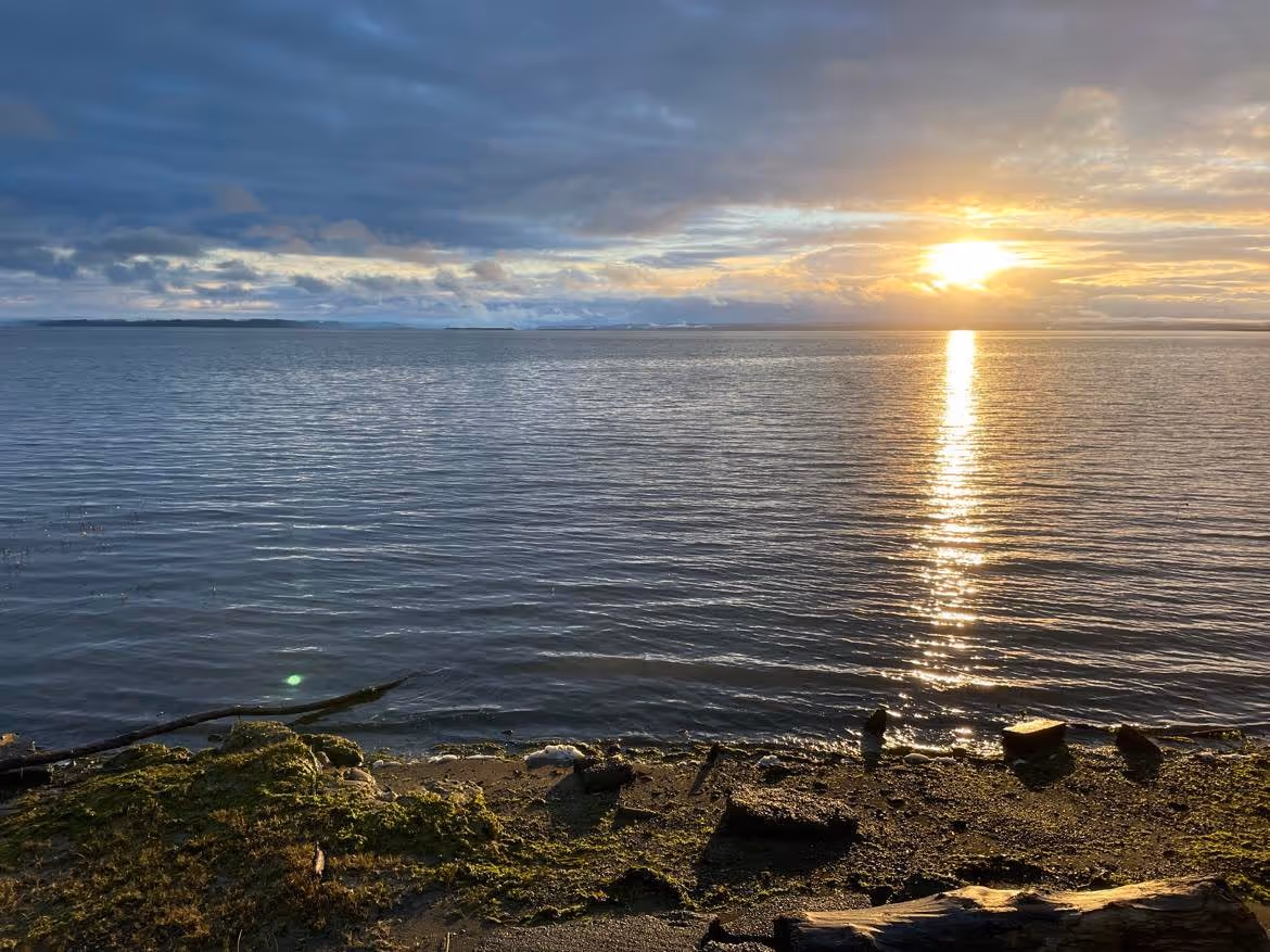
The Humptulips River outflow enters directly into Grays Harbor. In this region of the river it is tidally influenced which means that the river’s water level changes directly as a result of the rhythm of tides along Washington’s Pacific coast. As the Humptulips enters Grays Harbor it is characterized by low flow and muddy substrate, but it is still a great place to fish. A fishing access is located off of HWY 109 just east of the bridge crossing the river. Large Sitka spruce, western hemlock, and alder trees line the river providing a cool and green and shady place to fish during sunny days.
Another fishing access is located near the Ocean Beach Road bridge near Copalis Crossing. It is the Thorberg Boat Launch. At this access point, the Humptulips River has more gravel and cobble substrate, important for supporting a diverse array of freshwater life, including fish. A larger access to the river is found along Hansen Road, a west turn-off of US HWY 101 south of the town of Humptulips. The river has larger cobble substrate and during late spring and summer it has a slow flow at this point. Boats may be launched here, as well, for canoeing, kayaking, or fishing. The wide beach is ideal for a picnic with plenty of skipping stones for kids of all ages.
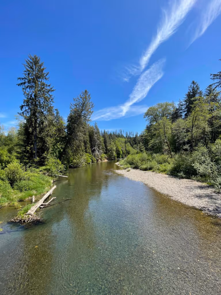
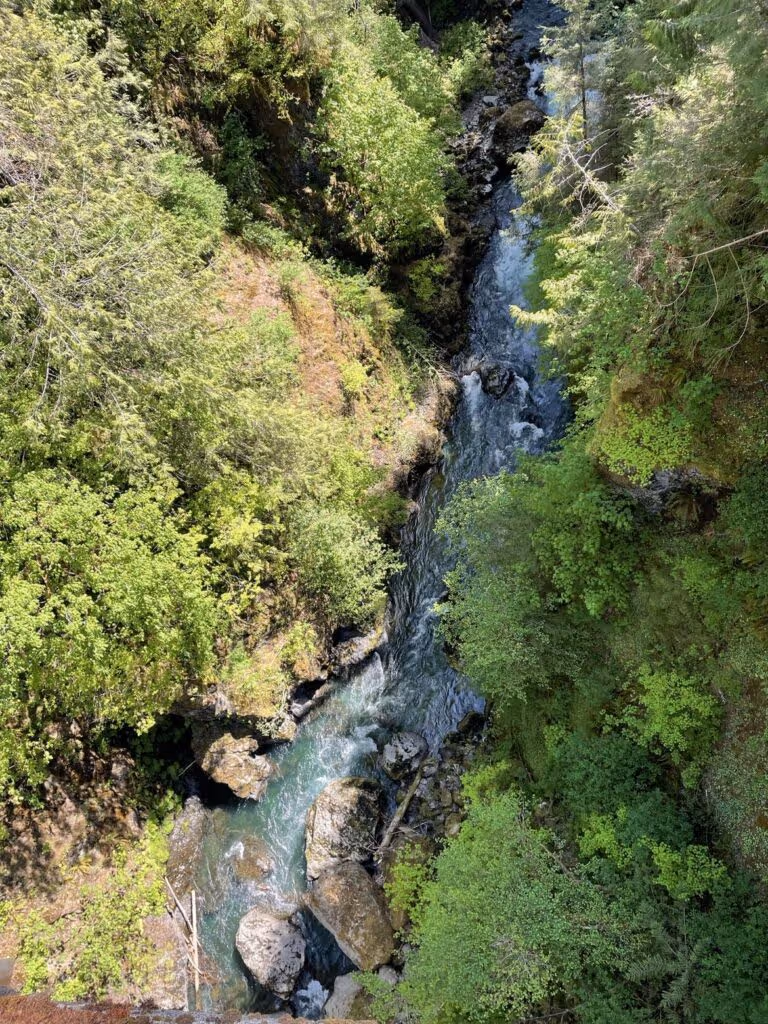
Several access points are found in the USFS Olympic National Forest lands. An awe-inspiring view of the West Fork Humptulips River is seen when crossing the river via Donkey Creek Road. Cliffs line the river upstream of the bridge along the western shore and forest with both deciduous and coniferous trees line the river downstream of the bridge. While exploring this part of the river, American dippers (Cinclus mexicanus, Swinson 1827) may be observed. Dippers are the only aquatic song birds in the Western Hemisphere. They are found primarily in western rivers and streams of North America and Central America. This small, gray bird actually walks underwater! They dive in search of the aquatic macroinvertebrates that live on the rocks. American dippers often nest in cliffs, so their nests are likely found along the cliffs lining the western shore of the West Fork Humptulips River.
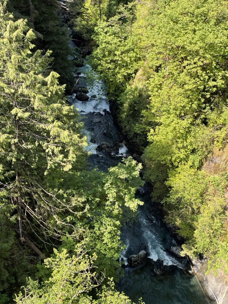
Continuing up Donkey Creek Road, a left turn along road NF 2404 leads to a river gorge. A short trail emerges from a well-maintained parking lot allowing views of the gorge and river upstream. This is a stunning area and less than an hour from Ocean Shores, Aberdeen, and Hoquiam. Numerous trails are found upstream of this point in the USFS Olympic National Forest.

The upper reaches and headwaters of the West Fork and East Fork of the Humptulips River drain hills and mountains of the Olympic Mountains. The East Fork headwaters are very near the headwaters for the West Branch of the Wynoochee River, separated by ridges and mountains rising up to 3000 feet. The West Fork of the Humptulips River is separated from the Quinault River watershed by mountains rising up to 4000 feet. Although these dividing ridgelines and mountains are not very high relative to peaks in the Cascades and Northern Rocky Mountains, they do exhibit a steep gradient going from 3000+ feet to sea level in less than 60 miles. One may leave the rainy coast and climb into a snowy wilderness in a short period of time during winter and early spring.
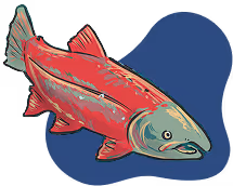
Pacific salmon are anadromous, meaning that they start out life in freshwater, swim out to the ocean, then return to reproduce or spawn in the freshwaters from which they hatched. Salmon runs refer to the time of the year when anadromous salmon swim upstream back to their natal streams. Many change colors and they do not eat during their run. Chinook, coho, chum, and steelhead spawn upstream in the Humptulips River Watershed. Fishing is allowed, but regulated during this time and regulations vary by season. Typically, salmon may be caught during September through November with some fish allowed to be retained, although wild coho and wild Chinook must be released with a few exceptions (see resources below for more details). Limits and timing for fishing vary based on the health of the Pacific salmon populations and other factors. In 2022, some fishing was shut down when historic low water levels imperiled fish communities resulting from a combination of increased heat and reduced oxygen in coastal rivers. The Humptulips River and its tributaries was closed to fishing in October 2022. Eventually, fishing resumed after the late October rains increased river levels.
Although the Humptulips River receives water from snowmelt in the Olympic Mountains its hydrograph is mainly driven by precipitation from winter rains. Peak flows over the past three years were from November through February with a smaller series of peak flows in the spring, possibly indicating the input from snow melt at that time. See the resources below if you want to plan a canoe or kayaking trip during the best flows for rivers of the Humptulips River watershed.
For more information read:
All About Birds. 2023. American Dipper. Cornell Ornithological Laboratory. https://www.allaboutbirds.org/guide/American_Dipper/overview#:~:text=A%20bird%20that%20walks%20underneath,wings%20to%20negotiate%20the%20current. (Last accessed 30 May 2023).
Data Basin. 2014. Washington State River Miles. https://databasin.org/maps/new/#datasets=f5e7ff87fd6942d09d08e7cfb7292f2c. (Last accessed 30 May 2023).
Meany, Edmond. 1919. Origin of Washington Geographic Names (Continued) The Washington Historical Quarterly, 10(3): 190-204 https://www.jstor.org/stable/40473957.
National Weather Service. 2023. Hydrology Education: Hydrographs. https://www.weather.gov/lot/hydrology_education_hydrographs#:~:text=A%20hydrograph%20is%20a%20way,visually%20on%20a%20single%20graphic. (Last accessed 30 May 2023)
United States Geological Society. 2023. Humptulips River Below Hwy 101 NR Humptulips, WA – 12039005. https://waterdata.usgs.gov/monitoring-location/12039005/#parameterCode=00060&startDT=2020-05-29&endDT=2023-05-30. (Last accessed 30 May 2023).
United States Forest Service. 2023. Olympic National Forest Map. https://usfs.maps.arcgis.com/apps/Embed/index.html?webmap=14bfddfb03f64cbe9c25376348f9f1ea&extent=-124.9873,46.7276,-121.6145,48.5703&home=true&zoom=true&scale=false&search=true&searchextent=true&basemap_gallery=true&disable_scroll=true&theme=light. (Last accessed 30 May 2023).
Walgamott, A. 2022. Major Fishery Closure on Washington Coastal Rivers. Northwest Sportsman (6 October 2022). https://nwsportsmanmag.com/major-fishery-closure-on-washington-coastal-rivers/ (Last accessed 30 May 2023).
Washington State Department of Fish and Wildlife. 2023. Season summaries and agreed fisheries. https://wdfw.wa.gov/fishing/management/north-falcon/summaries#coastal. (Last accessed 30 May 2023).
Western Rivers Conservancy. 2023. Washington: West Fork Humptulips River. https://www.westernrivers.org/projects/wa/west-fork-humptulips-river. (Last accessed 30 May 2023).
© Barbara Hayford, May 2023
Touch whale bones, examine shipwreck artifacts and connect with the coast's living history.

Support our mission, get involved in educational programs, or contribute through donations and volunteering.